Water presents a multifaceted set of issues that can rapidly become the touchstone for community acceptance or otherwise of resource developments. Not only are issues of water availability and quality important but water also presents an intrinsic set of values that are often interwoven into people’s perceptions of the issues. This elevates the importance of “getting water right” as an imperative in obtaining social licence to operate.
Groundwater, because it is largely hidden below the earth’s surface, presents additional challenges. Every time a bore is sunk the data it provides is only a small window into an otherwise complex system. Managing groundwater resources requires multidisciplinary analysis of multiple attributes of many bores as well as an understanding of local and regional geology. Numerical models used to predict the impacts on water availability are usually viewed as “black boxes” by community members and not to be trusted. Distrust is also fuelled by a lack of transparent access to groundwater information.
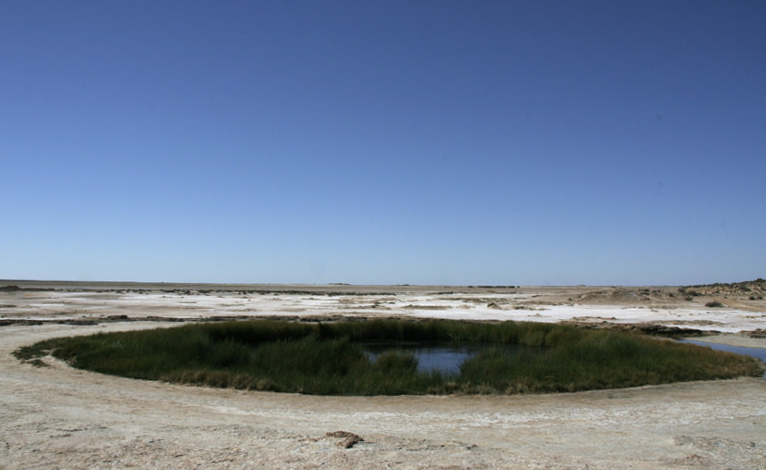
Sustainable management of water resources of the Great Artesian Basin (GAB) has been a contentious issue almost since it was first used for agricultural supply. Consequently the prospect of the introduction of the coal seam gas industry in the Surat Basin area of the GAB was met with resistance. The most compelling issue rapidly became understanding the risks that extraction of water from the coal seams would potentially present to other aquifers used for agricultural production.
The 3D Water Atlas of groundwater and geology was developed as an industry, community, government and University collaboration in response to the concerns about groundwater impacts of coal seam gas development in the Surat Basin region of the Great Artesian Basin.
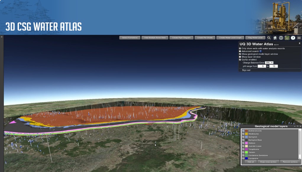
The Atlas is an online web based visualisation and analysis tool for water managers in industry and government as well as interested community members. It allows non-expert and expert users alike transparent access to the latest updated government and gas company groundwater data, geology and other commonly available 2D and 3D spatial datasets. The interface is intuitive and easy to use. All data has been rigorously quality assured and controlled.
The Atlas provides many services. It is a platform for analysing and comparing groundwater level and chemistry changes over time in a single bore, between multiple bores and in relation to geology, landuse and other attributes. Cross sections can be automatically generated to view changes in geology with depth and across regions of interest as well as viewing the location of bores within the cross section area. The ability to interrogate groundwater data within the geological context without specialist software is a novel and innovative approach that advances knowledge and allows more effective communication of groundwater systems. Prior to the development of the Atlas anyone wishing to access groundwater data from even a single bore would be required to collect data from multiple spreadsheets and reassemble the information in a useable format. The atlas allows this to be done with the click of a mouse on a single bore or the fencing of multiple bores.
Finally, because the Atlas is available on-line it can be used as an interactive communication tool in the paddock, schools and public forums as well as for research. The real value of 3D visualisation is in how the viewer can also instantly form a mental model of the data and information being viewed and how multiple attributes interact. Some landholders are using the Atlas to extract data and verify information for their properties. The real value in the Atlas is that it has contributed to a shared understanding of water resources in the Surat Basin and provides a transparent record of likely impacts of changes to water resources in the system.
