Ecosystem altering weeds are considered to be one of the major threats to the long-term success of post-mine rehabilitation. Therefore, many mine sites closely monitor the presence, abundance, distribution, and spread of declared weed species in their rehabilitated areas. Monitoring for weeds is traditionally carried out through ground-based field work and visual assessments. However, these methods can be slow, costly, and labour intensive. In contrast, remote sensing can help overcome these issues by monitoring large areas of land for detecting and controlling weeds.
Until recently, remote sensing techniques had limitations that impeded the monitoring of weed species. These limitations have been importantly overcome by the advancement of remote sensing technology, through the miniaturisation of sensors that can be mounted on drones.
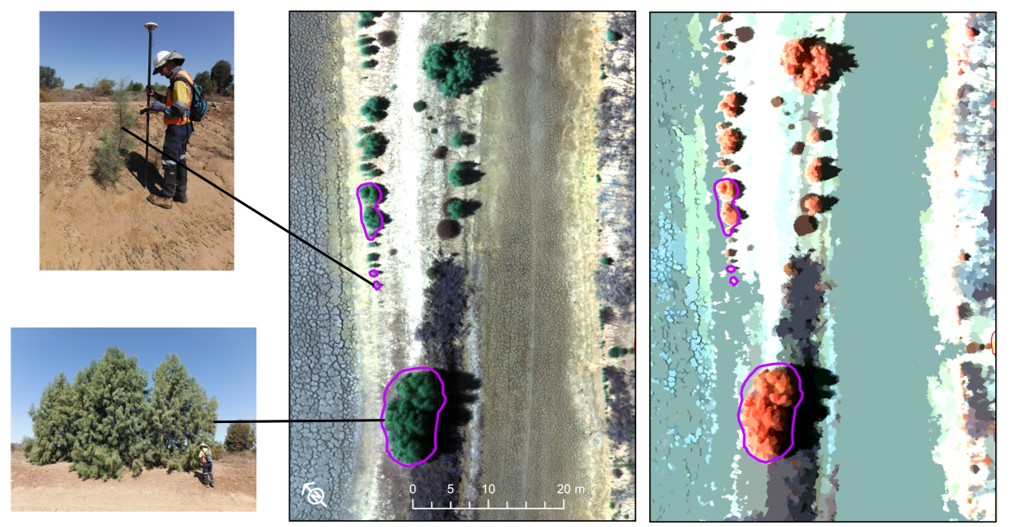
Drone-imagery allows spatial resolutions that are fine enough to differentiate vegetation, often to the level of individual trees or shrubs. Using computational algorithms that detect spectral and structural differences across images, we can distinguish different species of vegetation. This allows the identification of weeds, information that can be used to develop management actions to remove these threats to rehabilitation.
Case Study
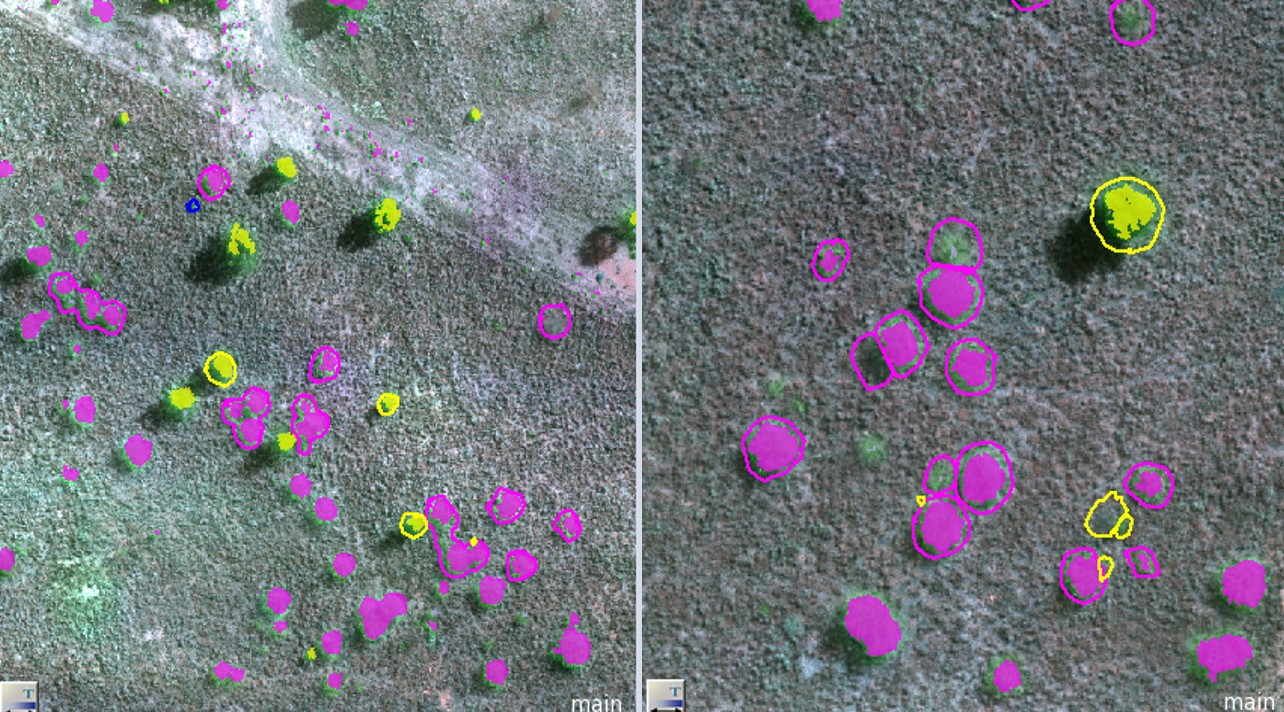
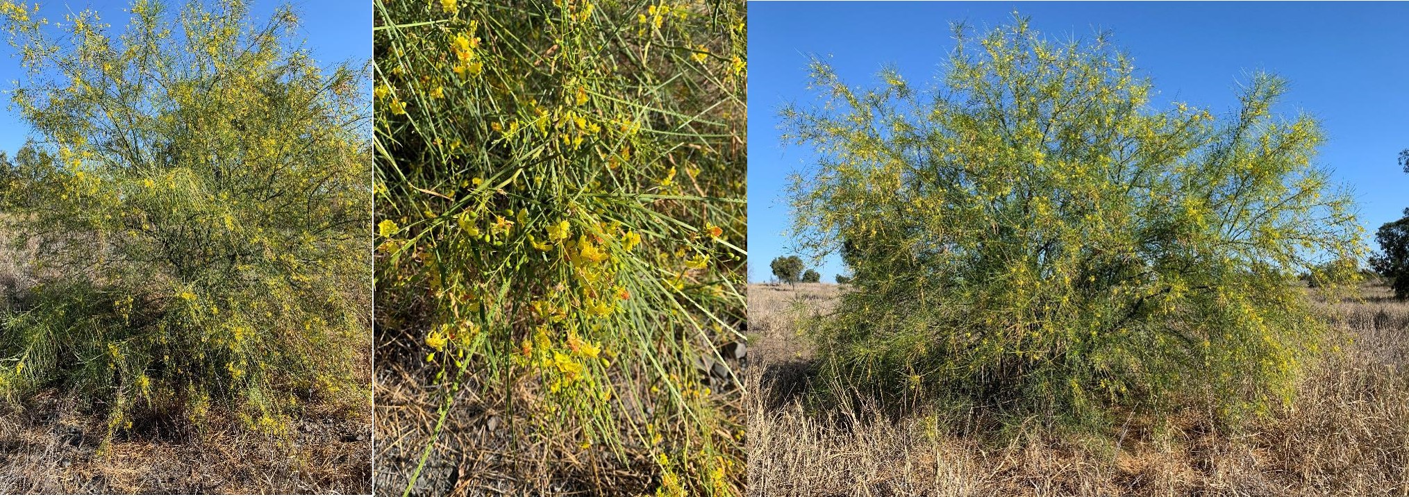
In this project, we use 5-band drone imagery (including Near Infra-Red and Red Edge bands) to detect two significant category 3 invasive plants (Biosecurity Act 2014) Athel pine (Tamarix aphylla) and Parkinsonia (Parkinsonia aculeata) shrubs found in areas of rehabilitation.
We are testing classification approaches including Object Based Image Analysis (OBIA) and Machine Learning algorithms (e.g. Support Vector Machine; SVM). Also, we are comparing the performance of these approaches to detect weeds at different resolutions. Different resolutions were acquired by re-sampling the highest resolution imagery (pixel of ~4cm per side) to lower resolution images (up to ~27cm).